Renovation, retrofitting and brownfield projects share one common risk: incomplete or inaccurate existing-condition data.
When dimensions are missed, levels are approximated or services are undocumented, the result is almost predictable—site re-visits, change orders, redesign cycles and inflated survey costs.
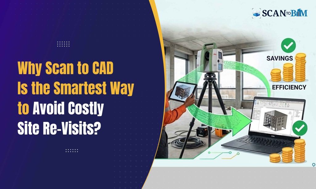
This is where Scan to CAD fundamentally changes the workflow.
Instead of relying solely on manual measurements and fragmented documentation, laser scanning captures millions of data points within minutes, creating a highly accurate digital representation of the site. When processed correctly, this data becomes precise 2D drawings or 3D CAD models that the teams can confidently design from.
Let’s break down technically how this reduces the site re-visits and overall survey expenditure.
- Capturing Complete Site Data in a Single Visit
Traditional surveys depends heavily on selective measurement. Surveyors decide what to measure based on the current project scope. But renovation projects often evolve and missing dimensions later require another visit.
Laser scanning captures:
- Structural geometry
- Slabs, beams, columns
- MEP services
- Ceiling voids
- Façade conditions
- Irregular or non-orthogonal geometry
Because scanning captures everything within the line-of-sight, the teams can extract additional dimensions later without returning to site.
A well-executed scan reduces dependency on multiple measurement rounds and limits fieldwork to one structured visit.
- Minimizing Human Measurement Errors
Manual measurement introduces risk due to:
- Tape sagging or parallax errors
- Limited access areas
- Inconsistent datum references
- Transcription mistakes
Laser scanners operates with millimeter-level precision thus creating a dense point cloud. When processed into the drawings through professional Scan to CAD Services, the output maintains geometrical integrity across plans, elevations and sections.
This accuracy reduces:
- Design clashes
- Re-dimensioning exercises
- RFIs based on dimensional discrepancies
- Costly construction corrections
Fewer errors directly translates to fewer return visits.
- Enabling Remote Data Verification
One of the biggest cost drivers in surveying is logistics:
- Travel time
- Equipment mobilization
- Site access permissions
- Safety compliance procedures
Once scanning is complete, architects, engineers and consultants can verify the dimensions remotely within the digital environment.
If an architect needs a new sectional cut or additional façade measurement, it can be extracted from the point cloud instead of arranging another site trip.
This remote accessibility significantly reduces:
- Travel expenses
- Downtime between clarification cycles
- Consultant coordination delays
- Supporting Multidisciplinary Coordination
Projects involving structural retrofits, HVAC upgrades or façade modifications requires coordination between multiple disciplines.
In traditional workflows:
- Each consultant may conduct their own measurements.
- Overlapping surveys increase redundancy.
- Data inconsistencies creates coordination conflicts.
A centralized scan dataset allows all the disciplines to work from a single verified base.
When a qualified Scan to BIM Company converts the point cloud into the structured digital models, teams can integrate structural, architectural and MEP data within the coordinated environments thus reducing the duplicated surveys.
- Improving Access to Difficult or Hazardous Areas
Industrial facilities, heritage buildings and operational commercial spaces often restrict access.
Revisiting such sites increases:
- Safety risks
- Permit requirements
- Downtime costs
- Insurance liabilities
Laser scanning minimizes the need for prolonged physical presence. Even the complex areas like high ceilings, roof structures and congested plant rooms can be captured quickly.
Capturing comprehensive data in limited-access windows prevents the costly re-mobilization.
- Reducing Change Orders in Renovation Projects
Incomplete surveys are a leading cause of:
- Scope creep
- Unexpected structural conflicts
- Rework during construction
When existing-condition drawings lack accuracy, contractors discover discrepancies onsite—often after procurement has begun.
Accurate CAD outputs derived from scanning reduce ambiguity, ensuring that:
- Quantities align with real geometry
- Fabrication drawings matches the actual dimensions
- Prefabricated components fit correctly
Preventing even a single major redesign cycle can offset the cost of scanning multiple times over.
- Accelerating Design Decision-Making
Design teams often delay decisions while waiting for clarified measurements.
With a high-resolution digital record:
- Designers can verify wall thicknesses instantly
- Engineers can assess the slab deflections or misalignments
- Interior teams can plan services without guessing the ceiling clearances
The reduction in decision latency shortens the project timelines and eliminates the interim site clarification trips.
- Financial Impact: A Practical Cost Comparison
Consider a mid-size commercial retrofit project:
Traditional Survey Workflow
- 2–3 site visits
- Multiple consultant trips
- Redimensioning cycles
- Travel and accommodation costs
- Rework due to missed data
Scan to CAD Workflow
- Single comprehensive scan visit
- Centralized data extraction
- Reduced coordination conflicts
- Minimal consultant travel
While scanning may appear as a higher upfront line item, total lifecycle cost—including the avoided re-visits, redesign time and construction corrections—often proves significantly lower.
- Data Longevity for Future Phases
Another overlooked advantage is long-term usability.
Once captured, the scan dataset can be repurposed for:
- Future expansions
- Facility management
- Tenant fit-outs
- Asset documentation
Instead of re-surveying the same building years later, teams can extract updated information from the archived datasets.
This transforms the scanning from a project expense into a long-term digital asset.
Conclusion
Site re-visits are not just inconvenient—they are expensive, time-consuming and often symptomatic of incomplete data capture.
Scan to CAD reduces these inefficiencies by:
- Capturing comprehensive geometry in one visit
- Eliminating manual measurement errors
- Enabling the remote verification
- Improving multidisciplinary coordination
- Supporting safer, faster fieldwork
For renovation and retrofit projects especially, investing in accurate digital capture at the outset prevents cascading costs later.
In today’s fast-paced construction environment, the question is no longer whether scanning costs more upfront—but how much repeated site work costs over the lifecycle of a project.
And in most cases, the savings speak for themselves.